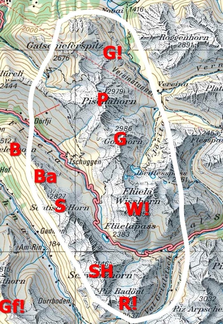
 The Flüela Valley offers the most tours of the 3 side valleys (Sertig, Dischma, Flüela) around Davos. From the beginning of the year to May, the Flüela Pass Road is closed and one can only drive the car to Tschuggen (1937m). If the pass is open, the Flüela Scharzhorn (SH, 3145m), the Chlein Schwarzhorn (2967m, North of SH) and the Radüner Rothorn (R!, 3021m) are worthwile touring peaks. Also note that the Pischa Bahn might not always be running. So check before you want to climb the rewarding Pischahorn (2980m) or do the epic “Gatschiefer” Tour.
I will start on the upper right/Northeast side and then head down/South and up/North again on the left/West side.
The tour numbers mentioned in my tour descriptions correspond to the tour numbers on www.map.geo.admin.ch, the site of the official Swiss maps, which now also include the ski touring routes. Type “ski” in the search bar and select “ski routes”. Please also note that altitude numbers on the official Swiss maps might deviate slightly depending on the map scale (the new 1:25’000 maps show most peaks 1 m lower).
I have covered most peaks in that region in a previous report which mostly I copy hereby. There is a detailed tour map below which has a few more peaks/routes than in the map above. Radüner Rothorn (R!) and Gatschiefer Tour (G!) is not in the tour map below.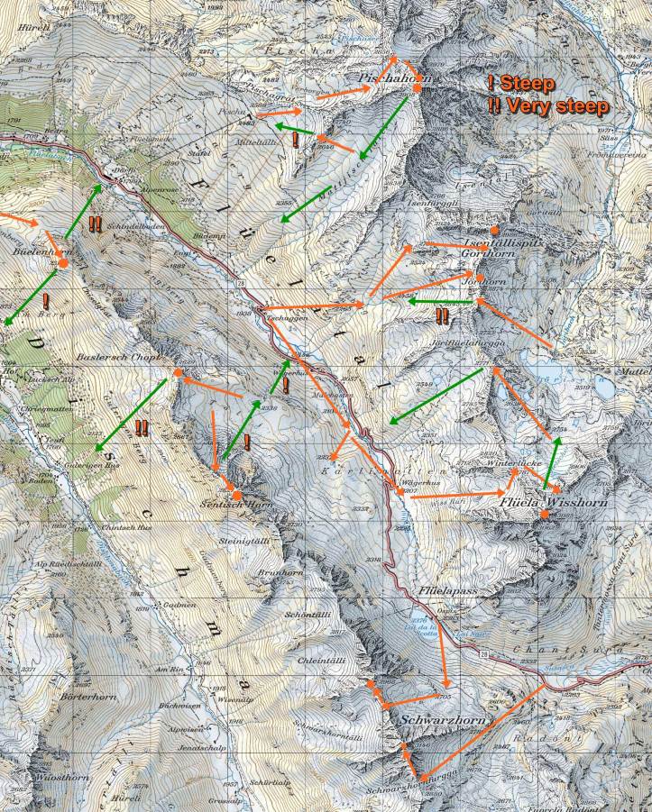
Gatschiefer Tour (2000m downhill), G! on my map, route 650b (more or less), epic ski tour with 2000m descent from Pischa to Klosters, 4-5 hours, not too difficult, but needs safe avalanche conditions (several people even with guides got caught in avalanches on this tour). You need to skin up twice (about 350m each) on this tour. Please note that you should go well equipped (physically and equipment-wise) on this fairly long tour. Tour report with tour map here.
This is clearly one of the best tours in the Eastern Alps with a total of 2000m descent if conditions are good and safe and if there is enough snow down to Klosters (1100m)! I will just mention here the “usual” route which differs significantly from route 560b (starting from Pischa Horn) on the offical ski tour maps.
Route: Pischa Top Station (2482m) – head Northwest to point 2460m – ski down towards East to about 2330m (steep!) – skin up Northeast to alp hut at point 2708m – ski down to Novaier Tälli (take a route that starts close to point 2719m which is safer) – skin up heading Northwest to point 2471m (or 2478m East of it) – ski down Gatschiefer Tälli heading North (i.e. on the East side of the valley) – ski down through for the steep terrain with trees/forest (best wy not so easy to find).
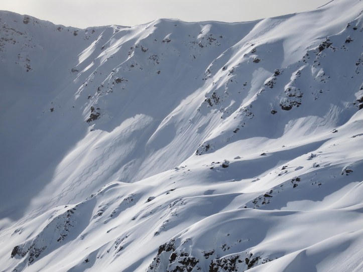
Avalanche warning: On this tour there have been several and some deadly avalanche accidents. A friend of mine got caught in an avalanche (with a guide) in the steep North Eastern slope above Novaier Tälli (i.e. East of the hut at point 2708m). The most dangerous part here is right at the top of the ridge (see foto below). Also, a client of a German mountain guide, got in an avalanche (and died as far as I know) on route 560b North West of Pischa Horn. Also, SLF lists a deadly accident in the slopes down to Pischaboden. So, watch out!
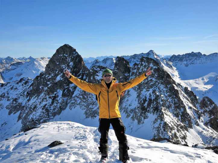
Pischahorn 2980m: P on my map, Routes 557a & e, probably the most popular ski touring peak in the whole region, 2 hours up, 40min down, pretty easy with one steep face on the ascent, tour report here.
The Pischahorn is easily reached from the Pischa ski area. There is rather steep “Spitzkehren” ascent to the ridge North of Pischahorn (seen on the very left in the picture below). This part can be done also with skis on the back if the snow is hard.
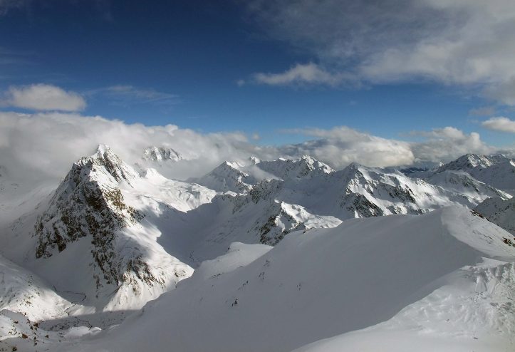
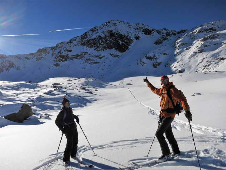
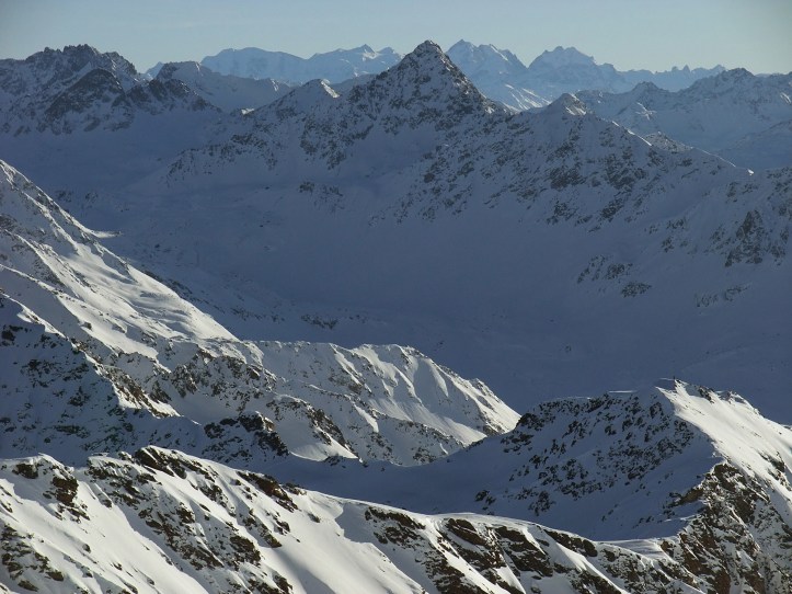
On top there is a sweeping view of the Silvretta moutains all the way the 4000m Bernina.

For the descent, first head down the South ridge about 100m-200m and then turn East into the broad Matjisch Täli. Be sure to have the skis waxed as the Matjisch Täli has some flat parts.
Tip: Instead of skiing down all the way to the Flüela Pass road where the snow is usually poor, one can also skin up again on the ridge just above the Pischa ski area (between point 2645m and 2739m) and ski down the steep slopes into the ski area. One can also cross back to the Pischa ski area at around 2450m.
” K2″ / Point 2838m: See detailed tour map, easy to reach peak (South of Pischahorn) from Tschuggen route 556a (more or less), safe in most conditions. I believe the locals call it “K2”. Certainly much easier than the real K2.
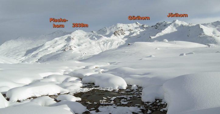
Görihorn/Isentällispitz 2986m, G on my map, route 555, rather easy, but last climb to the peak very steep. While the tour is called “Görihorn”, the actual peak climbed is the Isentällispitz
The Görihorn is avalanche-wise a pretty safe ski tour. Head up more or less straight from Tschuggen. Nice tour. Great views from the top.
Jörihorn 2844m, see detailed tour map, Route 554, easier but longer than Görihorn, recommended.
Flüela Weisshorn, W! on my map, Route 551a, intermediate tour, climbing to the top might need crampons and ice axe, exposed, many tourers stop at the saddle at 2900m
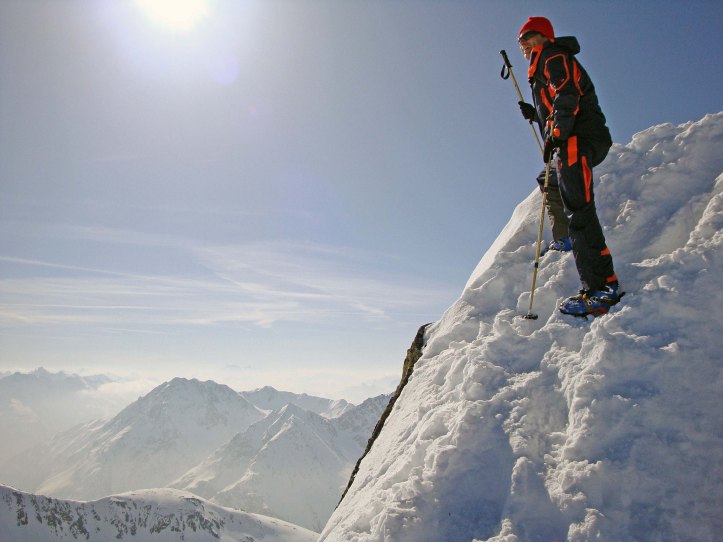
The “classic alpine tour “in the region. Thus there are always tracks on the way up. Follow the pass road for a while and then head up to the left. Once the ridge below Flüela Weisshorn is reached (2785m), one has to cross the North slope of the peak. Soon the “ski depot” at a small pass (2900m) is reached. Many tourers stop here and enjoy the view. The climb to the peak is a bit demanding and can be quite dangereous if the snow is hard. The mountain has two peaks, the peak to the South East is a few meters higher, but requires some climbing: so most people stop at the “Steinmannli” (rocks piled up).
The daring ones take the skis all the way to the top and ski down from the top. We have done it twice in very safe conditions. Here is a picture of the North face, the ascent is on the ridge to the left (the ridge on the right can also be climbed, by the way), the descent from the top is in the middle:
From the ski depot, there is almost always great powder down into the “Wöschchuchi” (“washing room”) to point 2623m. As seen here from above:

Putting on skins again, one can head back to the Flüela Valley over point 2771m (normal way) or via Jörihorn (1 hour longer and very steep uphill, need safe conditions). Here is a view of the two alternatives:

From Jörihorn there is a great (!) couloir down (not so easy to find):

Whatever route you take back, you will remember the Flüela Weisshorn tour!
Radüner Rothorn 3022m: R! on my map, Route 537a, very nice tour in early winter or late spring, less travelled alternative to Flüela Schwarzhorn, ascent over Rothorn Furgga and Southeast face, if you traverse over the Northwest ridge on the way down things can get tricky depending on snow conditions, ie. some climbing required to get down. Start at Pass Road East of Ospiz (2263m) – Rothornfurgga (2882m) – Radüner Rothorn (3022m).
This a tour which can be done in early winter (before the pass road closes) or in late spring. Great scenery and easy ascent, last part is steep, but doable. Descent via the North Ridge can be tricky!
The descent on the ascent route is relatively easy, but not very rewarding. The descent over the Northwest side can be tricky and depending on snow conditions might require some downhill climbing which I do not like. The “best” way down is to ski one of the very steep Eastern couloirs starting a bit Northwest from the peak.
Flüela Schwarzhorn 3145m: S on my map, Route 536b, highest peak of in the Flüela region, relatively easy, usually done only when the pass is still open, not great for skiing, but great views, often rocky, pretty safe in most conditions. Tour descrpition see here.
Klein Flüela Schwarzhorn 2967m: see detailed tour map, Route 535, intermediate to easy, usually no tracks, done only when the pass is still open, good late fall tour. Start directly from the pass. Pretty straight forward. A bit steep towards the end.
A bit further North there is also Point 2742m which can be skied. A nice and pretty steep short tour.
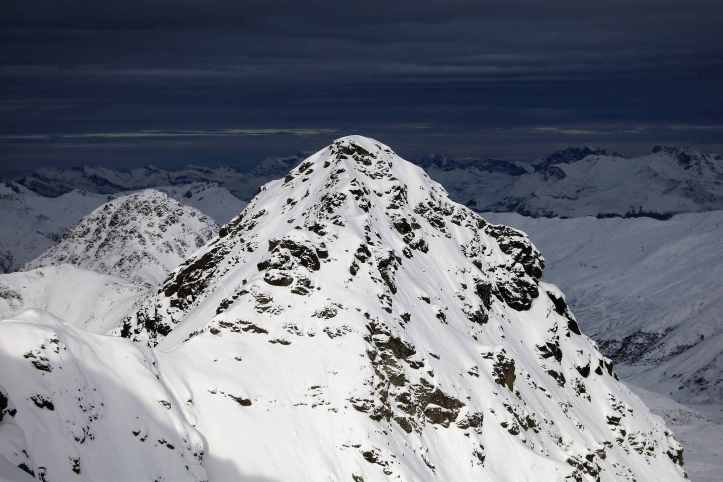
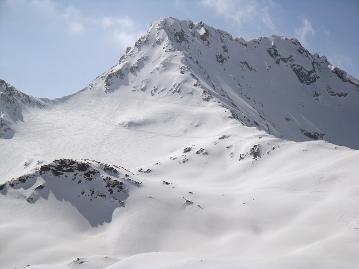
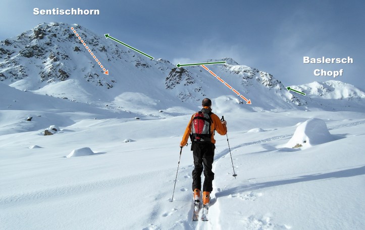
Sentisch Horn 2826m: S on my map, Route 534a, easy, a bit steep at the top, the steeper descent alternatives need safe conditions, tour report see here. Very popular tour.
Nice half-day tour with great views and powdry downhill descent (if avalanche conditions allow, seen on the right in the picture above). The direct descent from the top (left in the picture) is only recommended for daring skiers.
Baslersch Chopf 2628m: B on my map, route 533a, easiest tour in the Flüela region. Same way up in the beginning as Sentisch Horn. Pretty flat all the way up and down.
