The Zermatt region offers phantastic, high altitude ski touring with some of the 4000m peaks that can be reached easily. One starts from Klein Matterhorn top station at already 3900m. The easiest and closest peak with any real difficulties is the Breithorn (4159m). One can ski down back to Klein Matterhorn or – more popular – by the Schwarztor (“Black Gate”) over the Schwärze Glacier and Gorner Glacier back to Zermatt. There are usually many tracks there and very few – if any – crevasses.
Castor (middle, ascent through East face):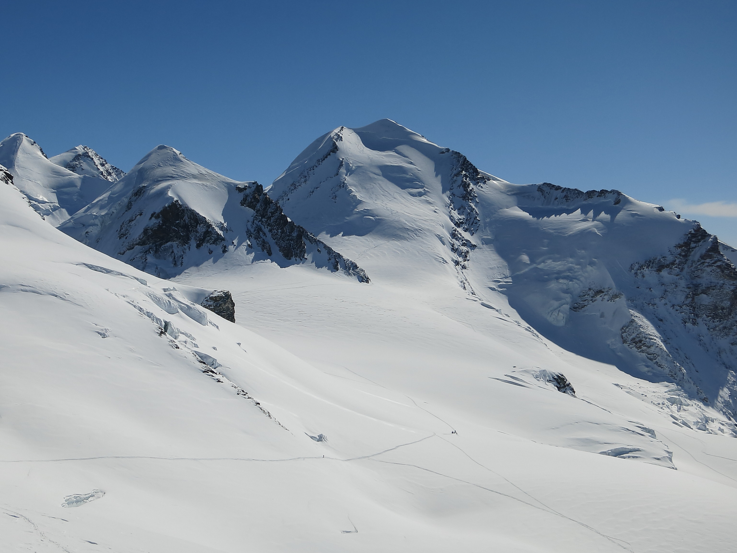 Castor (great ski peak, if it is not too icy)
The next peak on the way is Pollux (4092m) which is usually climbed with the ski on the back. A bit higher and more difficult is Castor (4223m). The steep East slope (see above) can be quite icy and then rampons and ice axe are often needed. We (André, Markus, Mauri and myself) climbed the peak in pretty good conditions mostly with skis on. There were only a handful of other people on the top and the weather was sunny and warm. We skied down right from the top ridge. Video of Mauri here.
Castor peak (narrow and icy ridge!):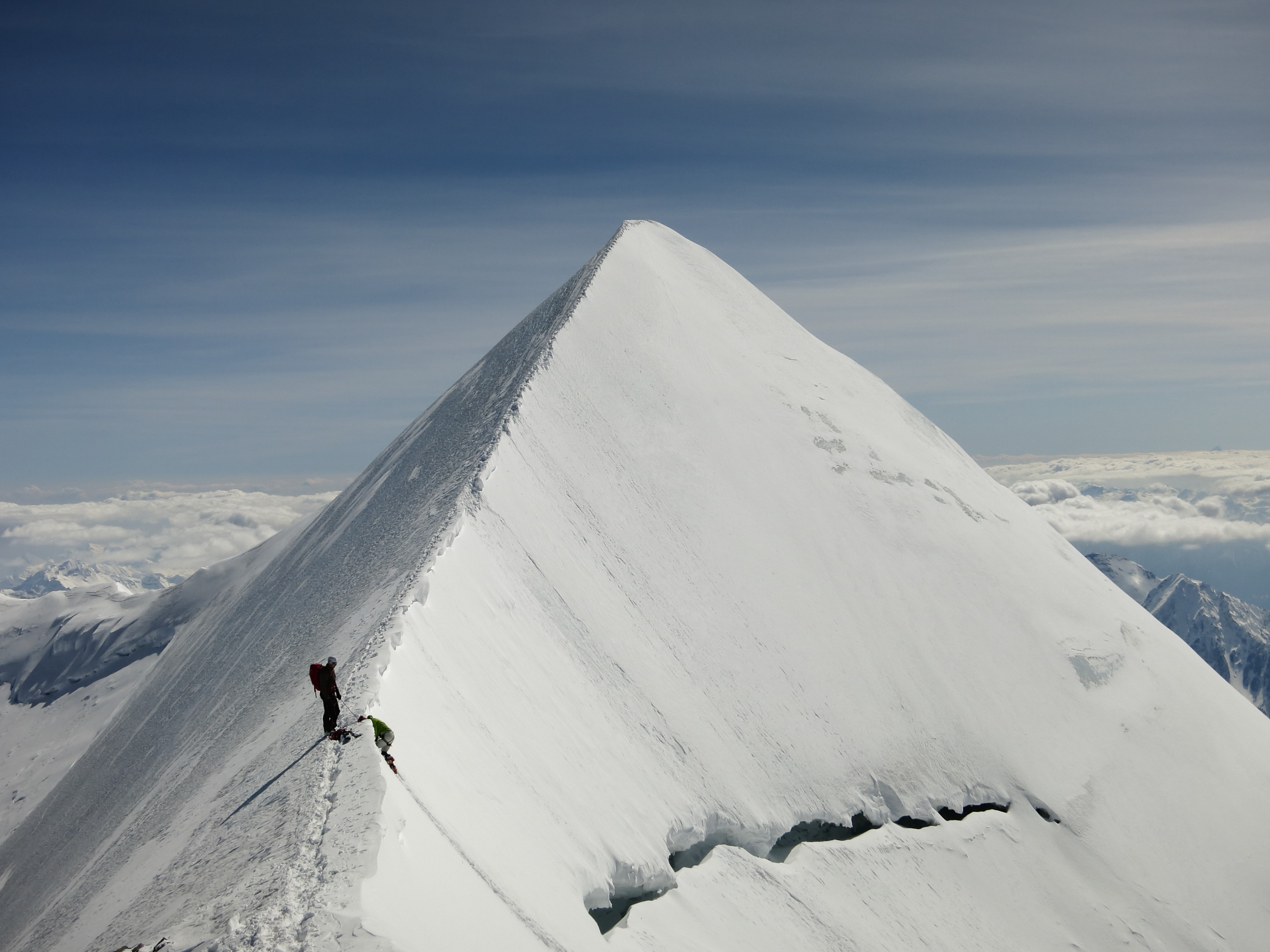
We skied down via Scharztor (as we were a bit late in the day). The more adventurous (and also more dangerous) route is via the Zwillings Glacier.
The snow conditions on the Schwärze Glacier were awful and we took a detour via the Schwärze Lake, just east of the glacier. Great powder there. Note: The last part of this route just above the Gorner Glacier is very steep (>40 degrees).
Evening over Gorner Glacier (on the way to Monte Rosa Hut):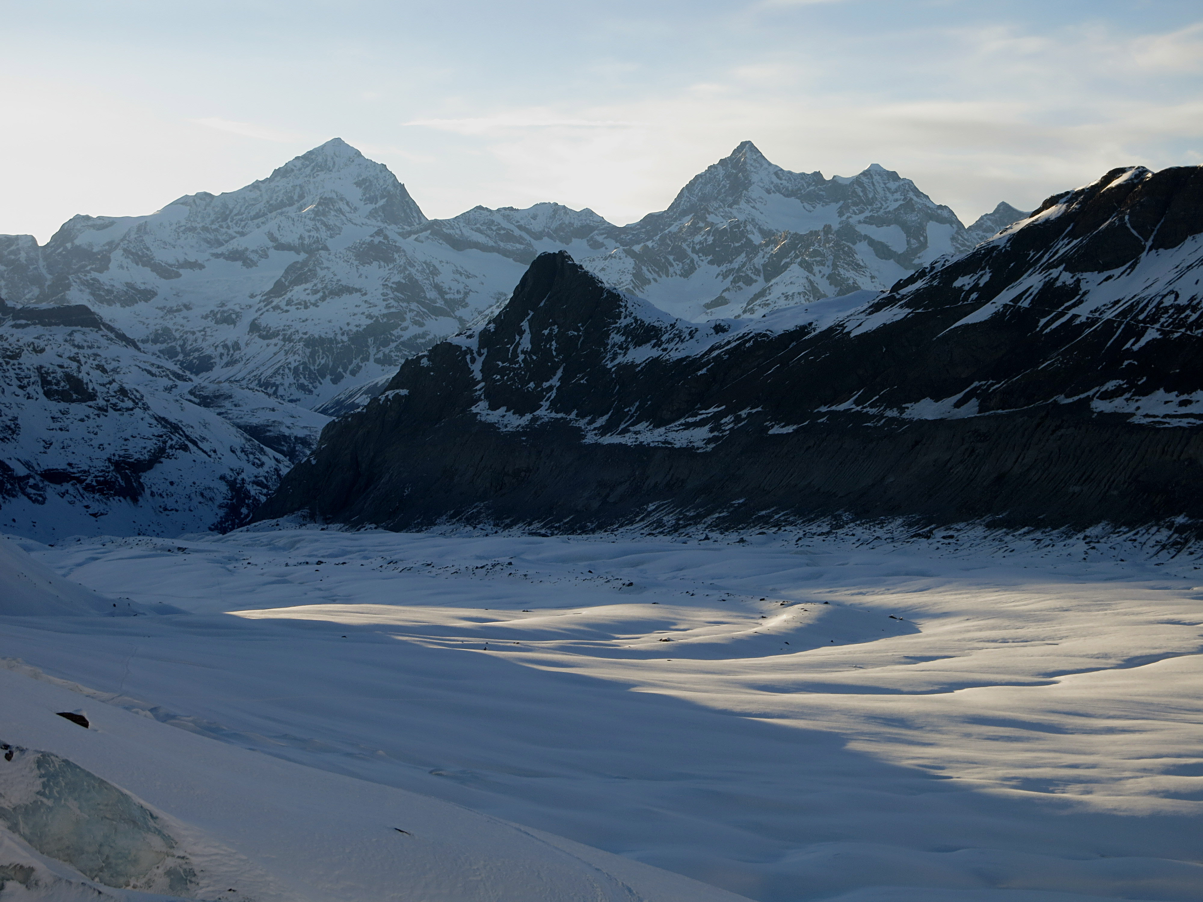
Monte Rosa Hut (lower middle):
Futuristic Monte Rosa Hut (http://www.neuemonterosahuette.ch/)
We skinned up to the Monte Rosa Hut in the evening sun and reached the hut just in time for dinner. The hut was not fully booked, so we were able to enjoy the great “dining room” and the comportable sleeping rooms. The night, however, was short, as breakfeast was served already at 03.00 (the other breakfast shift at 07.00 was too late for us).
Route to Dufour Spitze (as far as we made it):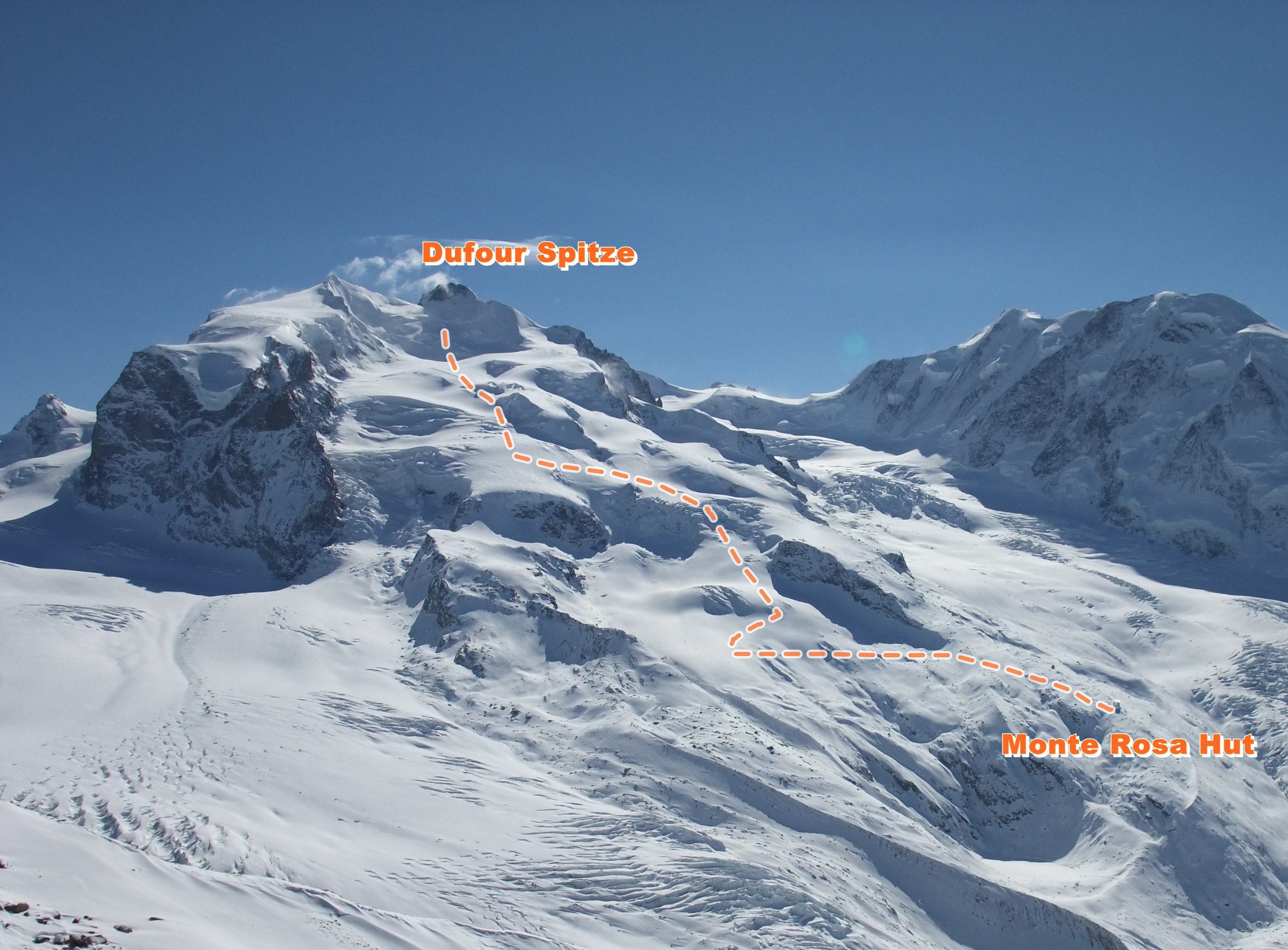
Dufour Spitze (attempt, Switzerland’s highest peak, 4634m)
At 04.30, we headed with our head lamps into the darkness hoping to find the tracks to Dufour Spitze (which we did). While the air was getting thinner and we got slower, we enjoyed a spectactular morning panorama (below). The ascent most of the way is very gentle and without difficulties.
Morning (Matterhorn on the left):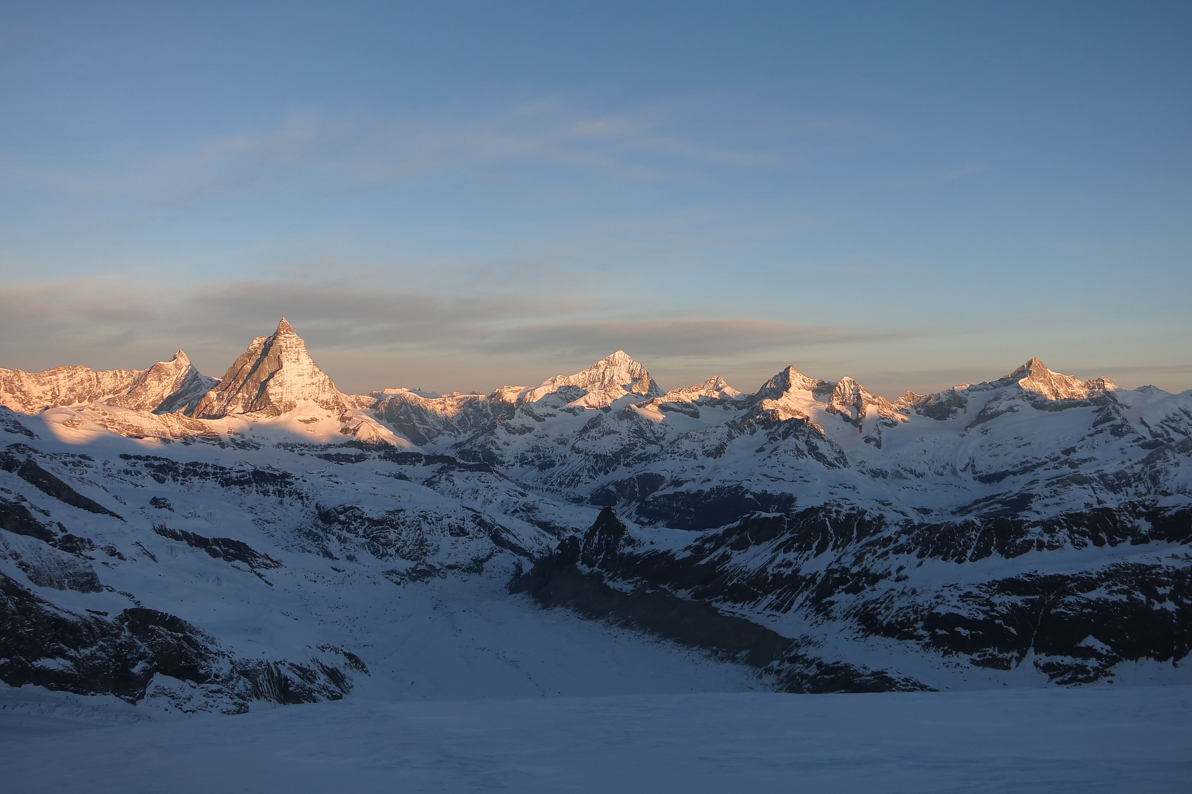
At around 1000m above the hut (at 3800m) a nasty and very cold wind started to blow and we “called it a day” at around 10.00 after having reached 4250m just below the “ice fall” below the Silbersattel. Being very cold and tired my/our motivation to climb higher (with skies on our backs) was limited.
Mauri, André and Markus at 4200m, ready to head back: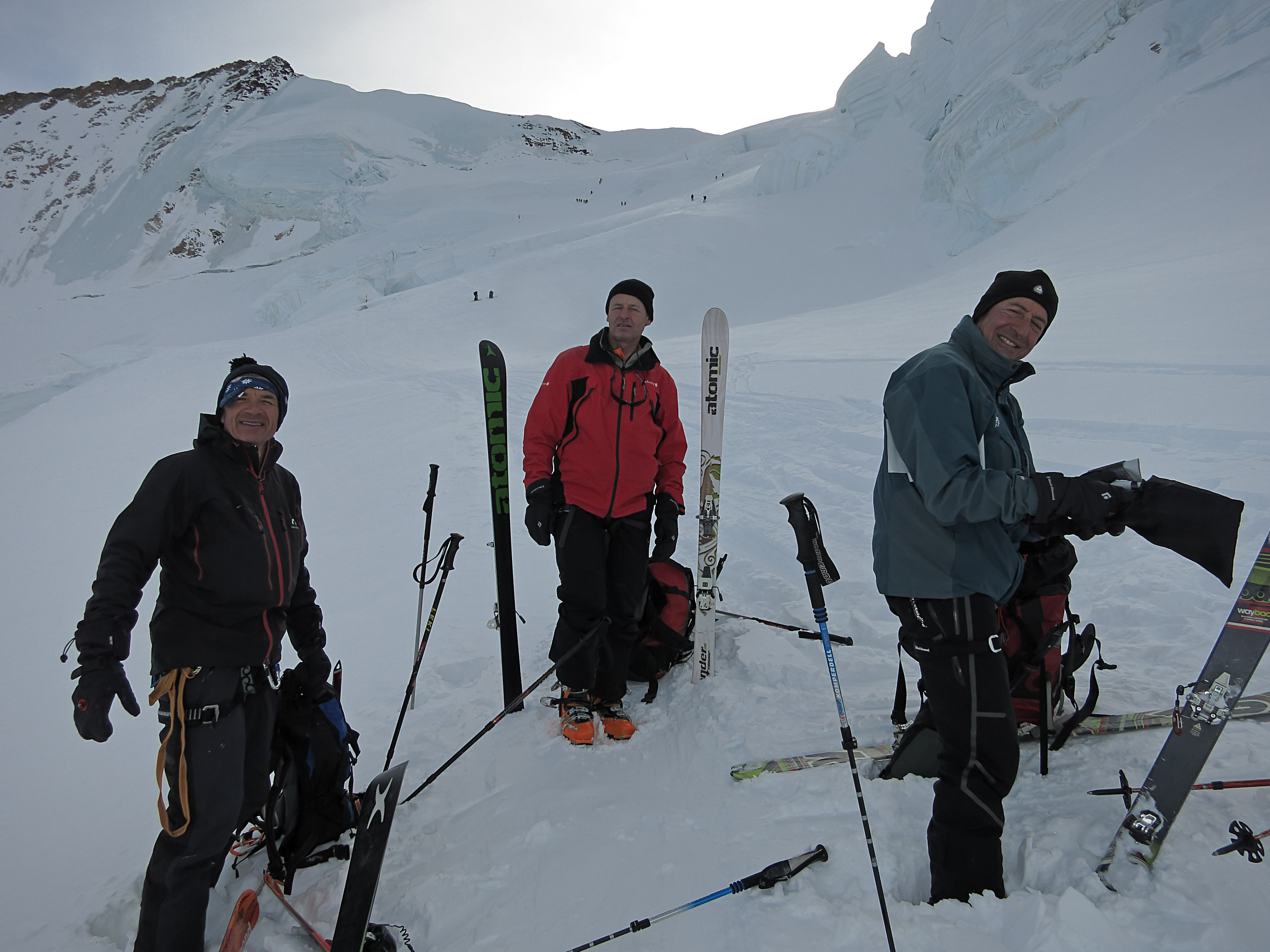
We skied down to Monte Rosa Hut for a drink and a soup. At around noon we headed back to Zermatt over the Gorner Glacier together with dozen of skiers (mostly with mountain guides) that came down from Schwarztor.
Looking back at Castor from Gorner Glacier (our route over Schwärze Lake, normal route back to the right on the Schwärze Glacier):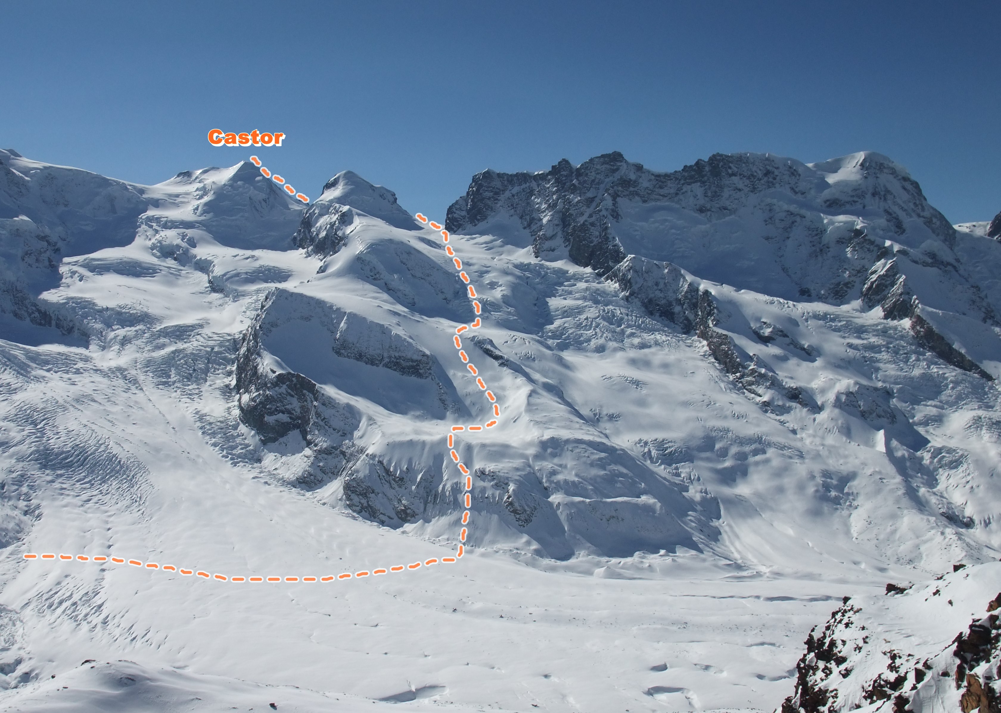
Overall, a great two days! Next time I/we want to go all the way to the top of Dufour Spitze!
Some more pictures:


That must have been a fantastic trip ….
Hello! Do you have GPS track of this route available? Could you send it by email? We’re planning our ski-route for next month and we’re looking for GPS tracks. Thank you very much!
Jorge
Dear Jorge
I do not have the GPS tracks, but can send you a map with the ski routes if you send me your email (my email ugeilinger@yahoo.com). Please aso note that the official Swiss maps (with ski routes) can be found on https://map.geo.admin.ch, then select Skitours.
Try this link: https://map.geo.admin.ch/?lang=en&topic=ech&bgLayer=ch.swisstopo.pixelkarte-farbe&layers=ch.swisstopo.zeitreihen,ch.bfs.gebaeude_wohnungs_register,ch.bav.haltestellen-oev,ch.swisstopo.swisstlm3d-wanderwege,ch.swisstopo-karto.skitouren&layers_visibility=false,false,false,false,true&layers_timestamp=18641231,,,,&E=2627656.67&N=1087975.00&zoom=5&layers_opacity=1,1,1,1,0.8
Please note that Dufour Spitze is now only possible over the West ridge (which involves climbing).
Uli
You are correct. Thank you, Uli
Thank you very much for your fast answer! I know Swiss maps website and we’re studying them, but we are looking for GPS tracks to charge it at our GPS and follow them in case of bad weather. Please send me these maps you mention to txortxe@gmail.com.
About Dufour Spitze we were planning to climb it from Monte Rosa Hutte to Silbersattel, it’s not possible? We’ll be there at end of March.
Thanks again!
Jorge